Canadians Get New Google Maps Features for Safer Navigation During COVID-19
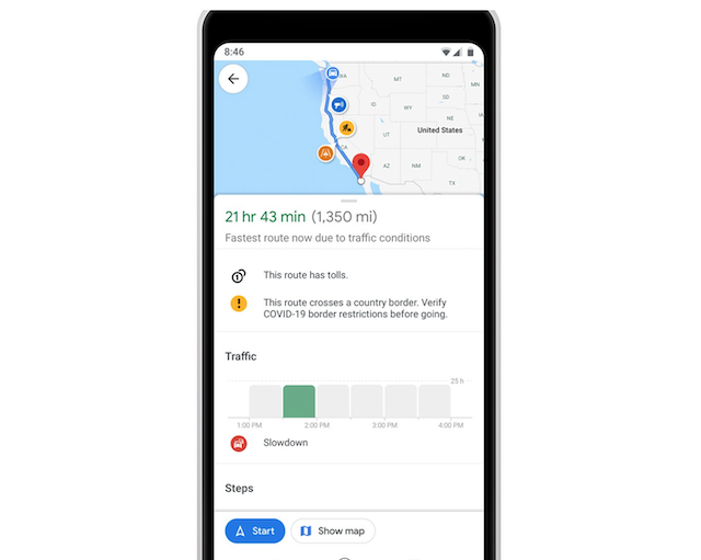
To help Canadians easily find important information when travelling during the COVID-19 pandemic, several new features have been added to Google Maps, including travel alerts which show where there are government-issued border restrictions.

According to the latest Canada Community Mobility report, transit mobility is steadily increasing among provinces, including Ontario. It is therefore now more important than ever that we know how crowded a transit station might be at a particular time or whether the bus is running on a limited schedule.
Following Ontario’s recently released Public Transit Safety Guidance, Google Maps has added these new features for Canadians:
- A refresh to the crowdedness predictions. It will now be simpler for users to contribute crowdedness information for their transit lines so that others can avoid crowded stations and reduce risk of exposure to COVID-19 when they need to travel. Users everywhere will have access to past rider feedback and can submit their own, right alongside public transit routes when available.
- Station busyness. To make it even easier for people to see how busy a transit station is, we’ll surface more popular times/ live data on the transit departure board. Simply search for a station in Google Maps, or tap on the station on the map to see the departure board and busyness data, where available.
- Travel alerts to show where there are government issued border restrictions. These alerts will notify users where there may be prohibited, impacted, or inadvisable routes towards their destination.
Additional features, such as medical destinations and centres to get tested for COVID-19, are coming soon to Google Maps Canada.

