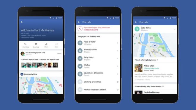
Facebook’s ‘Disaster Maps’ Aids Relief Organizations During Natural Disasters Facebook is working with three global relief organizations to provide disaster maps to aid first responders. iPhoneinCanada.ca Staff 7 years ago