In a new blog post at Google, Emma Upton, Quttinirpaaq National Park Manager with Parks Canada, has shared the story behind Google’s new Street View collection that captures the beauty of Canada’s Quttinirpaaq National Park, which is located nearly 800 kilometers from the North Pole and is home to 4000-year-old archeologist sites.

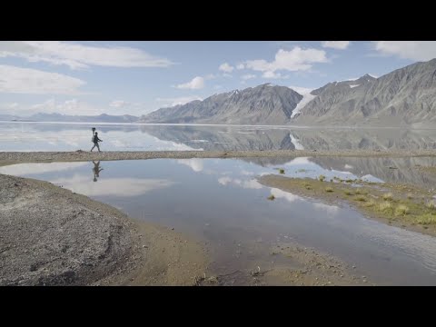
Emma and her team threw on the Google Trekker and explored the country’s second-largest national park’s incredible terrain, making it the furthest north Google Street View has ever gone. “Wilderness and extreme isolation characterize this area, where fewer than 50 people visit each year”, she writes, adding that the park’s name itself translates to “the top of the world” in local language.
“With treks along the ocean shoreline, climbs up to lofty ridges, strolls beside glacial melt-water rivers, and scrambles at the foot of monumental glaciers, the resulting imagery is spectacular—a digital reflection of one of the world’s most rural locations
Aside from Quttinirpaaq National Park, we captured Street view imagery of Grise Fiord, Canada’s northernmost community, and Resolute Bay, which has a population of just under 200 people. Internet access and bandwidth are challenging in this part of the world, but we wanted the people who live in and around the area to be able to enjoy the new Street View collection.”
To view all the the highlights, check out the gallery at this link.