New Canadian App FireFringe Detects, Maps Forest Fires for Public Safety
A new, free Canadian app called FireFringe can detect and maps forest fires and hotspots across the country, helping improve first response and public safety.

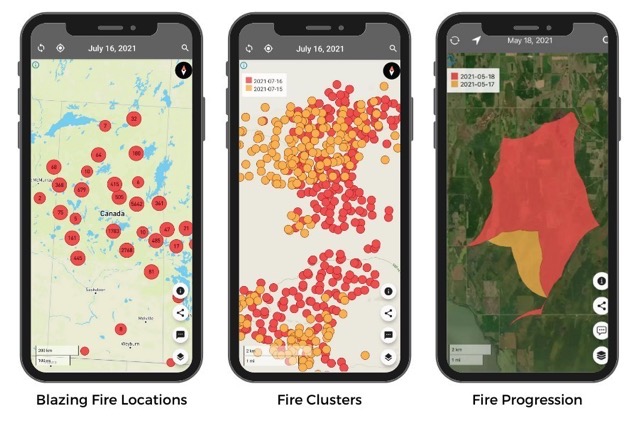
Developed by the First Resource Management Group (FRMG), the FireFringe app is now available to Canadian firefighters, emergency managers, municipalities, the media, and the public to see where fires are blazing in near real-time. The app leverages FRMG’s SkyForest technology to make detailed maps of forests and the trees growing there.
“Our app can help save communities. It shows where fires are beginning to grow and can help predict where they are headed. It’s simple and visual to keep people informed and safe,” said Phil Green, CEO of FRMG.

The app can help:
- understand what could be fueling a fire;
- track a fire’s progression;
- make better predictions; and,
- give more time to prepare and respond.
To download the app for free, you can use the following App Store link.
Download FireFringe for iPhone, iPad, and iPod Touch [Direct Link]

