
Get Transit Directions in iOS 6 via Google Maps on the Web
iOS 6 introduced Apple’s new mapping solution, replacing Google Maps. With the latter going the way of the dodo bird, some may be disappointed that local transit directions are not available anymore, unless you download a local transit app. Think again.
You can still access local transit directions in iOS 6 by using Google Maps–on the web. It’s quite simple, detailed, and even shows your location. Here’s how to do it:
1. Visit http://maps.google.com in Safari (and enable it to use your location).
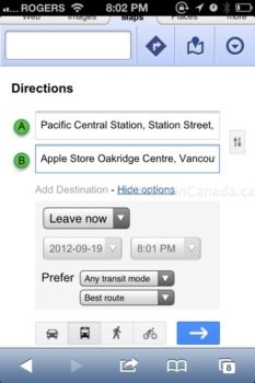
2. Tap on the directions icon–then enter in your start and end destinations (suggestions auto fill as you type; tap Show options to toggle kilometres).
3. Tap the bus icon, then the blue go arrow. Your transit directions will show below, plus there’s also a map view.
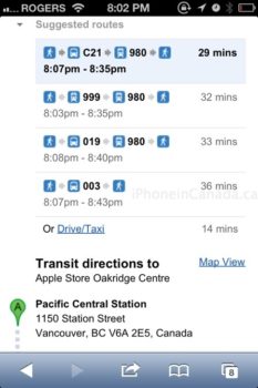
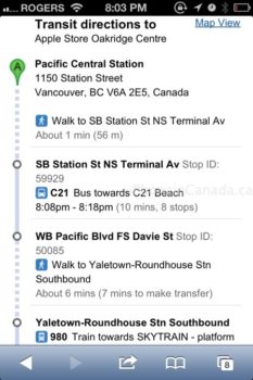
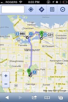
Here’s a deeper look at the detailed walking directions on getting to bus stops; on the left there is the map view, which you can tap on each station for further detailed info:
Here on the left, is the detailed bus stop info from tapping on the map; on the right, saving Google Maps to the home screen has a nice high res icon:
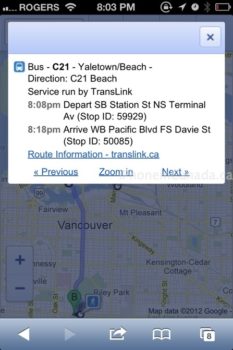

This Google Map view on the web brings back memories when Google Latitude was web-based. As you travel on the bus, your location will be shown on the map via a blue dot. You can even save the Google Maps web app to your home screen; the icon is Retina ready.
So there you have it–you can still get your transit directions in iOS 6 with Google Maps on the web. Advantages of using this way for transit directions is that you leverage the power of Google for your local area, no matter where you may be. Standalone transit apps are typically curated for smaller areas, and not the world.
Let me know if this free solution works for you.
Thanks @dezumondo!

