Google to Let Android Users in Toronto Contribute to Street View Imagery
Google Street View and Maps are getting an update that will allow users to submit immersive Street View photos using just their phone.

Google published a blog post to confirm its plans to start using user-generated content when it doesn’t have its own Street View data available.
More specifically, Google said Android users with ARCore-compatible devices will be able to capture and publish photos to its Google Street View service. Google is accepting submissions in Toronto, New York, Austin, Nigeria, Indonesia, and Costa Rica. Eventually, more regions will be added.
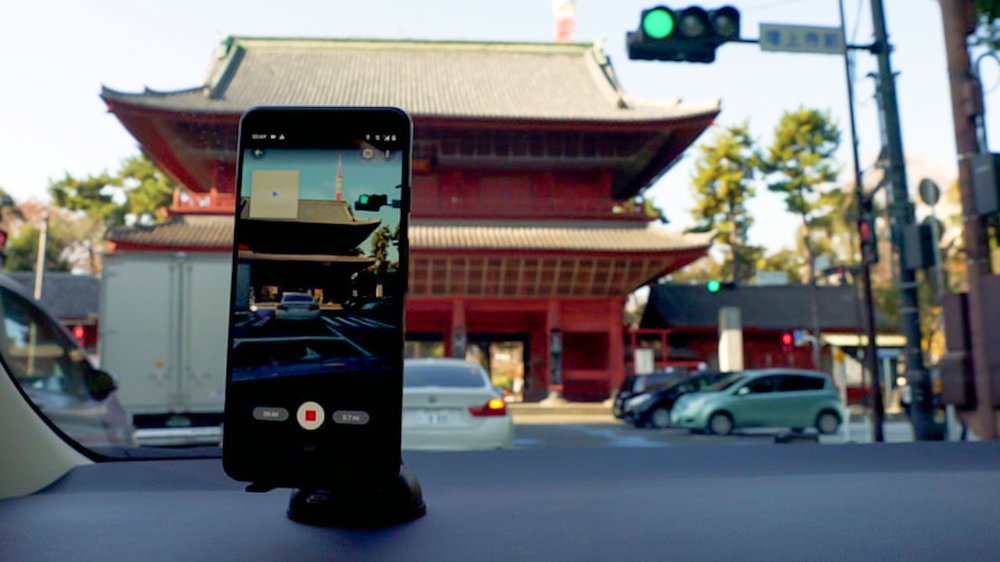
“With our updated Street View app on Android, it’s now easier than ever to collect your own Street View imagery and put it in the right place on Google Maps,” reads the post. “Using our new connected photos tool in the app, you can record a series of connected images as you move down a street or path.”
Users don’t need a special 360-degree camera or attachment to get started. Google said it can auto-rotate and position multiple photos captured in its Street View app for Android devices.
To get started, open the latest version of the Street View App, hit the new Create button in the navigation bar, and start recording images. It’s that simple.
“While our own Street View trekkers and cars have collected more than 170 billion images from 10 million miles around the planet, there are still many unmapped parts of the world,” explains the post. “Where people contribute connected photos, they will appear in the Street View layer on Google Maps as dotted blue lines.”

