
First Look: Toronto Transit Views within Apple Maps in iOS 9
When Apple announced Transit view for Maps in iOS 9 yesterday, the only Canadian launch city listed was Toronto, which again propped up the city as ‘the centre of the universe,’ to those living elsewhere.
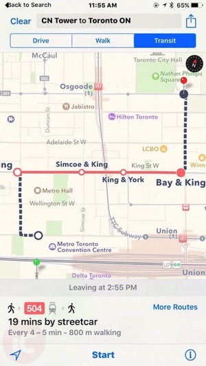
According to Apple, “Transit view shows you lines and stations right on the map. When you plan a route, every step of your trip is laid out from point A to point B.”
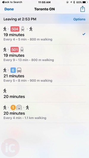
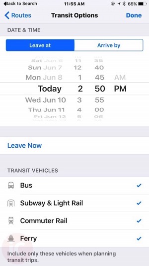
Below are a few first look views of what Transit views look like for Toronto within Maps in iOS 9. The addition of a ‘Transit’ tab now appears after Drive and Walk for method of travel. When ‘More Routes’ is tapped, other options appear that can be selected:
During the WWDC keynote, Apple also noted Transit details would also show entrances and exits for stations too, so you can plan your trip better:
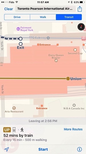
As you can see from the images above, transit details are pretty clear and straightforward. However, since Toronto is the only Canadian city at launch, surely this won’t replace popular third party apps such as the Transit App.
Are you excited to get Transit views in Maps when iOS 9 rolls out this fall? Or will you be sticking to something like Google Maps or others?
