Google Maps for iOS Can Now Measure Distances For You, Here’s How It Works
Google Maps for iOS gained a small update yesterday to now let users measure distances from dropped pins. The new “Measure distance” feature lets you manually draw a route and measure distances between points on the map.
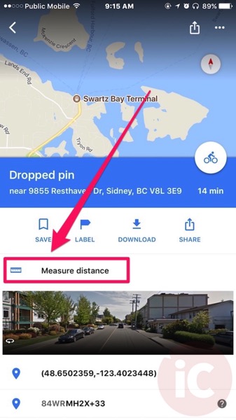
First, just drop a pin on the map, swipe up and then tap on the new ‘Measure distance’ indicator with the mini ruler icon:

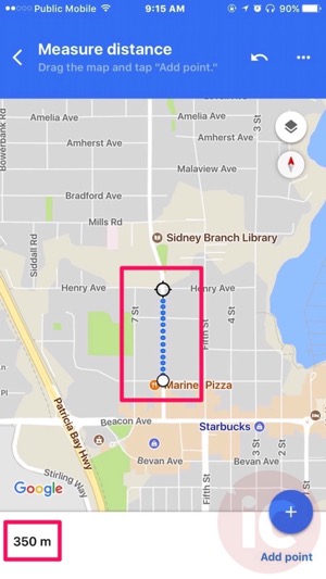
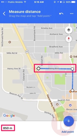
From here, you can then tap and drag the map to any location and in the bottom left, it’ll update the distance in real-time. Tap ‘Add point’ in the bottom right and you can then add another point and so forth. It’s a handy feature if you’re trying to determine how far distances are if you’re planning a walk with kids or a bike ride etc.


You can also tap the ‘back’ arrow to undo an added point as well.
Google says the update also includes bug fixes related to discovering new places and navigating to them.
Back in March, Google Maps for iOS added real-time location sharing, a feature similar to Apple’s Find My Friends, while a month later, it added a feature to remember where users parked, along with a ‘Your Timeline’ feature to track and record a log of where you’ve been.
Click here to download Google Maps for iOS in the App Store.

