Fitness-Tracking App Strava Wants To Sell Its Data To City Planners
Today Strava, a popular fitness-tracking app for runners and cyclists, has announced a new initiative. The company has decided to sell its location data to local governments, where city planners can put it to good use.
Since the app collects so much information about people on the move, city planners could use all that data to make urban living more manageable.
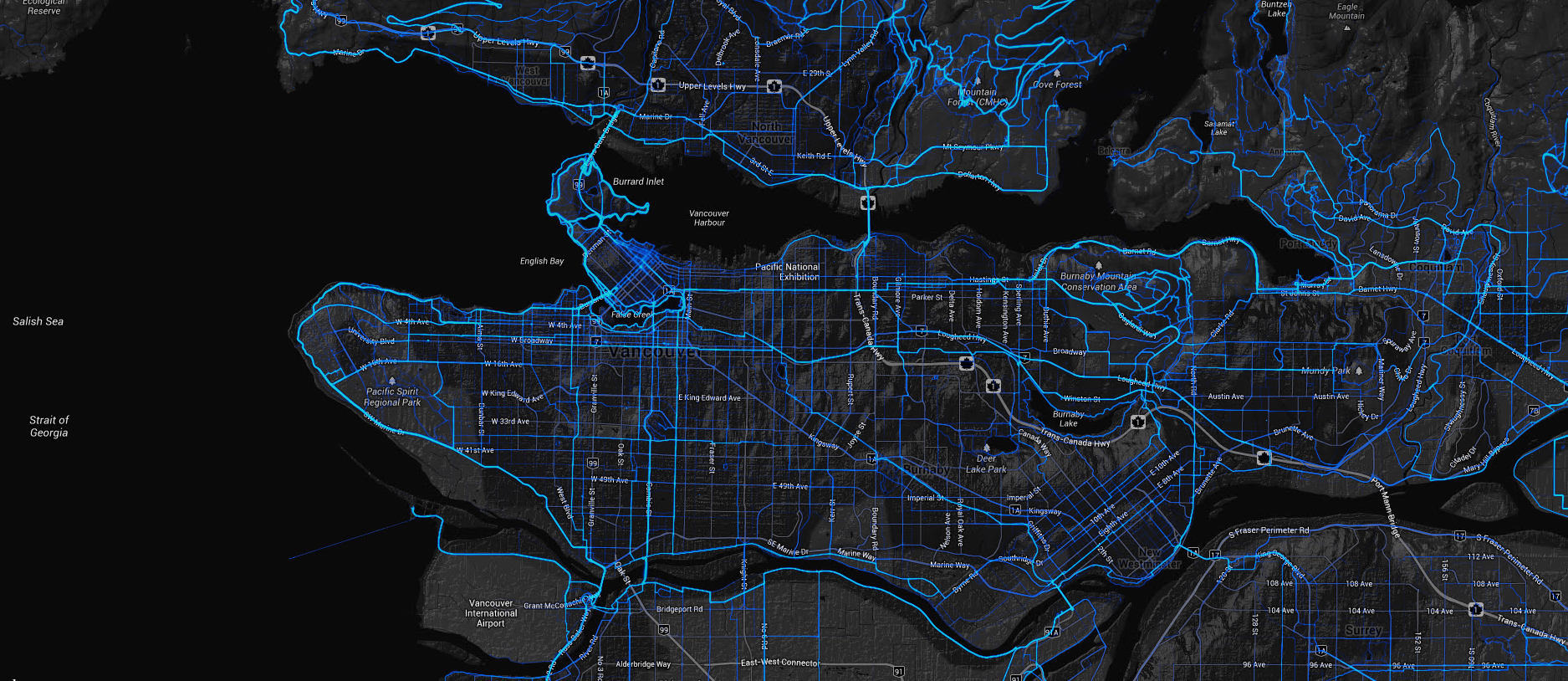
Strava Metro, which allows urban planners to understand the way cyclist use pubic streets, was announced by the San Francisco-based company on Wednesday. Currently, the service provides planners with data from 90 million bike rides and 24 million runs.
Urban planners for years have had access to detailed information about automobiles, but not cyclists. In the past six months, Oregon has used the Strava data to determine where cyclists have trouble figuring out traffic patterns, and to find the best way to install rumble strips on a road outside Portland that is popular with cyclists.
Michael Horvath, co-founder and president of Strava, said:
“There are potentially thousands of customers in the U.S. and the demand world-wide for Strava Metro is pretty substantial.”
Founded in 2009, Strava currently has a free app on both iOS and Android. The company will not disclose how many active users it has or how much revenue it makes of its premium subscription service. Click here to take a look at Strava’s heatmap, which shows the path most traveled by cyclists and runners, without the need for an account.
[via The Wall Street Journal]


