Google Spotlights its AI-Powered Efforts to Tackle Climate Change
At its “Sustainable with Google” event, Google has highlighted how it is using artificial intelligence (AI) to combat the growing threats of floods, wildfires, and extreme heat.

Climate change is already impacting communities worldwide, particularly those most vulnerable.
As part of Google’s commitment to address climate change, it is developing AI-driven solutions like predictions and forecasting to provide valuable information for individuals’ safety and community planning.
Forecasting Floods:
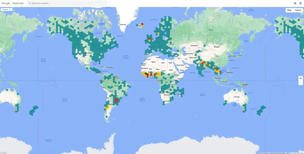
Floods, one of the most common natural disasters, have been a major focus of Google Research’s efforts. Their flood forecasting initiative, powered by advanced AI and geospatial analysis, delivers real-time flooding information.
This data is accessible on the Flood Hub platform, Search, and Maps, with coverage now extended to 80 countries, benefitting 460 million people.
Google recently expanded its riverine flood forecasts to the U.S. and Canada, covering over 800 locations and 12 million people. The aim is to bring flood forecasting to every country, collaborating with partners like the World Meteorological Organization.

Tracking Wildfires:
With wildfires on the rise, Google is using AI to map fire boundaries and predict fire spread.
Their wildfire boundary tracker, using AI and satellite imagery, updates every 15 minutes and is accessible on Google Search and Maps in fire-prone areas of the U.S., Canada, Mexico, and Australia.
Google is also collaborating with the U.S. Forest Service to update their fire spread model, using machine learning to enhance fire dynamics.
Extreme Heat Alerts:
To address the public health impact of extreme heat, Google introduced extreme heat alerts this year, providing users with information on heat wave predictions, cooling tips, and health concerns. These alerts are available in more than 80 countries.
Urban Heat Islands:
Google is helping cities combat “heat islands” by using AI and aerial imagery to identify shaded areas and recommend tree planting locations to reduce heat.
This Tree Canopy tool is expanding to over 2,000 cities globally, with a focus on equitable shade distribution. Google has partnered with American Forests to make tree canopy data available on their Tree Equity Score tool, benefiting a significant portion of the U.S. population.
Cool Roofs:
Google’s Cool Roofs tool uses AI and aerial imagery to map solar reflectivity, aiding urban planners and governments in identifying areas suitable for cool roof solutions, such as white roofs.
The pilot program is operational in four cities and will expand to 11 more, including New York, Nashville, and Melbourne.

